Measuring plans in Adobe Reader DC
Getting started
These instructions relate to using Adobe Acrobat Reader DC (free version) to measure and scale plans. This software is not supplied by Fareham Borough Council, nor does Fareham Borough Council take any responsibility for its use or functionality.
You can download software from Adobe  . PLEASE NOTE: For the measuring tools to be available, the PDF file must be opened in Adobe Acrobat (not in a web browser such as Edge).
Open measure tool in Adobe Reader DC
- Open the Measure Tool by selecting the Tools tab on the top left of the document or select the More Tools icon under the list of tools on the right.
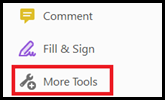
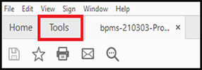
- In the Tools menu select the Open button under the purple Measure tool.

- The Measure Tool panel will now appear above the Plan.

Measuring plans
- Select the Measuring Tool to open the measuring toolbar and Display Tool box panel:

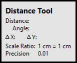
- The Display Tool box shows information about the measurement, such as current measurement, delta values, scale ratio and precision:
Change the scale ratio
- Ensure that the Measuring Tool is active.
- Right click anywhere on the document and select Change Scale Ratio and Precision to bring up the scale ratio box.
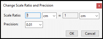
Note: The scale values are set by default and this will always occur when you first open the scale ratio and precision box. - Check the scale on the plan and use the table below to input the scale ratio:
|
Drawing scale |
Measuring scale |
|---|---|
| 1:20 |
1cm = 0.2m |
| 1:25 |
1cm = 0.25m |
| 1:50 |
1cm = 0.5m |
| 1:100 |
1cm = 1m |
| 1:200 |
1cm = 2m |
| 1:500 |
1cm = 5m |
| 1:1000 |
1cm = 10m |
| 1:1250 |
1cm = 12.5m |
| 1:2500 |
1cm = 25m |
| 1:5000 |
1cm = 50m |
| 1:10000 |
1cm = 100m |
Measuring types

If you are measuring scanned PDF plans, please make sure that the Orthographic Measurements is on. To turn this on, right click on the plan and select Turn Ortho On. You can do this in reverse to disable.
With the scale set, the measuring of the plan can take place. There are 3 different ways to measure:
-
Distance tool

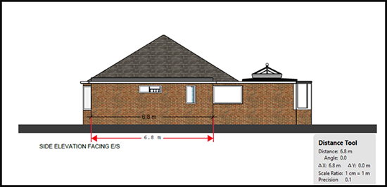
This tool will measure the distance between two points, which is ideal for measuring the distance of walls or the distance from an elevation to the boundary. Left click on the point you want the measurement to start and double left click on the end point. The distanced measured will appear between the arrows and in the Distance Tool box.
-
Perimeter tool

This tool measures a set of distances between multiple points. Left click on the point you want to measurement to start, then click on the points you wish to mark. Double left click to finish the last measurement. The distance will be indicated in the Perimeter Tool box.
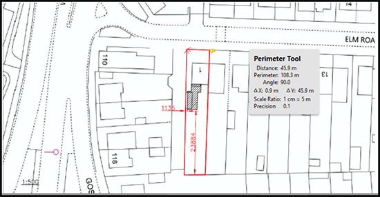
Note: If you want to measure an angle, left click on the start point, then draw a line towards where you wish to measure. Click once. Draw the second line away from this point and double left click to end the measurement. The angle between the two lines will be demonstrated in the Perimeter Tool box. -
Area tool

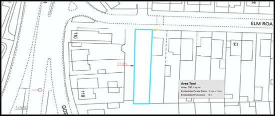
This tool measures the area within the line segment. Left click on the point you wish to start the measurement, then click on each further point you wish to measure before clicking on the point from which you started measuring. The area measurement will be calculated in the Area Tool box.
Notes:
- At any point when you are measuring, you can cancel the measurement by right clicking on the plan and select Cancel Measurement.
- To constrain the measurement lines to increments of 45º, hold down the Shift key.
- To delete a measurement markup, select the measurement and press the Delete Key.
You do not need to use the snap tools to measure. The snap tools allow you to snap directly to a line that is drawn on the plan. They toggle on and off by clicking on each snap type.

Colour of the measuring line
To change the colour of the measuring line:
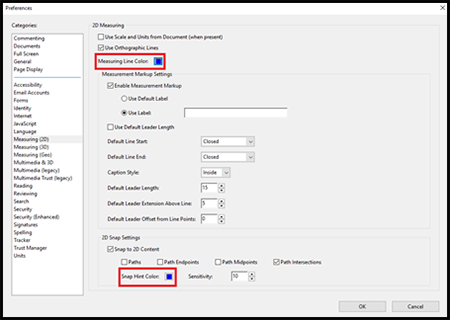
- Right click anywhere on the document and select Preference.
- Once the Preference menu opens, it will automatically open to the Measuring (2D) menu.
- Select the box next to Measuring Line Colour and select the colour you wish to use.
- Repeat the process for the Snap Hint Colour box.
- Once selected, click OK and the menu will close.
