Some of these cookies are necessary to make the site work. We’d also like to use optional cookies to help improve your experience on the site. You can manage your optional cookie preferences below. Using this tool will set a cookie on your device to remember your preferences. Your preferences can be changed at any time.
For further details, see our Cookie Policy and our Privacy Policy
Essential cookies enable core functionality such as page navigation and access to secure areas. The website cannot function properly without these cookies; they can only be disabled by changing your browser preferences. Third party functions such as Google Search and Analytics will not be enabled.
Performance settings enable you to use the Google Search engine on our website and help us to improve our website by collecting and reporting information on its usage (for example, which of our pages are most frequently visited).
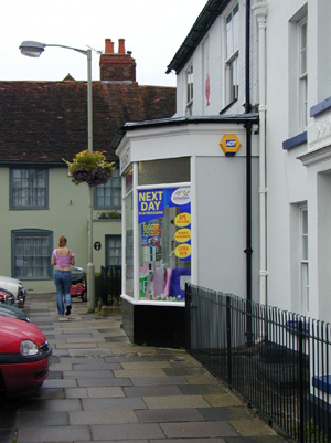
Titchfield village is set in the open countryside of the Meon Valley. It lies on the western bank of the river Meon, approximately 2½ miles west of Fareham town centre and dates back to at least the 8th century when the church was established. It was designated a conservation area in 1969 and the boundary was subsequently amended to include a larger area in 1994. The village grew from a medieval core, comprising High Street, Church Street, South Street and the lower end of West Street. Its attractive character arises from use of traditional local materials, the small scale of the buildings and the mixture of building styles which range from Tudor and Jacobean through to Georgian and Victorian. The undeveloped Meon valley provides an important wider setting for the village.
Fareham Borough Council has made an Article 4 Direction in Titchfield Conservation Area making a planning application necessary for certain types of development.
The Titchfield Conservation Area Character Appraisal Management Strategy was approved by the Executive on 7th January 2013. A copy of the report to the Executive and consultation responses to the draft document can be found here:
Consultation Responses ![]() (741 KB)
(741 KB)
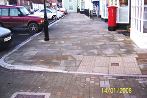
Area improvements (completed 2007)
This was a partnership with Hampshire County Council's country towns initiative. It included re-surfacing the footpaths in this historic square with high quality York stone and installation of traditional granite kerbs and more appropriate street lights.


 Back to Top
How to get here
